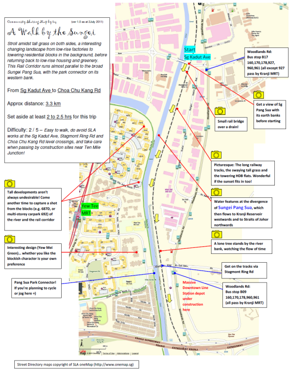
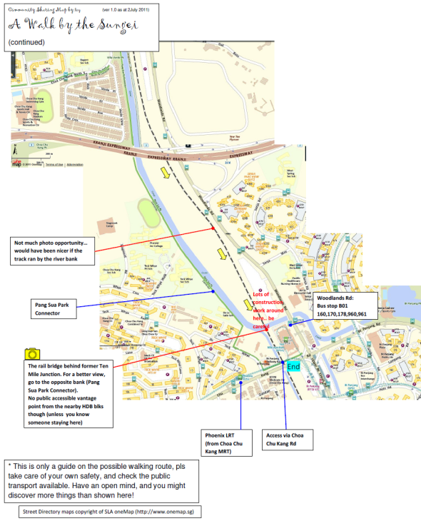
Walking route from Sungei Kadut Avenue to Choa Chu Kang Road
Here’s a map of A Walk by the Sungei – Walking route from Sungei Kadut Avenue to Choa Chu Kang Road, which includes good photo-taking spots. Thanks to the great effort from CY Leong!
Download high-res map of [download#2#size#nohits]
(Maps attributed to OneMap by SLA, http://www.onemap.sg/index.html)


I made a trip today intending to cover the Rifle Range Road to Rail Mall stretch as I thought that this is the only stretch of tracks that is still open to the public. In the event, I found that the tracks after Rail Mall has not (yet) been blocked and continued talking. Upon reaching Stagmont Ring crossing, I found that they had removed the tracks that once crossed the road. The access to the tracks from Stagmont Ring Road has been temporarily blocked as well although the rest of the tracks are still in place.
The rail bridge over the river in the southern part of this section has been removed. You will now need to walk around the mall and car park to continue the track.